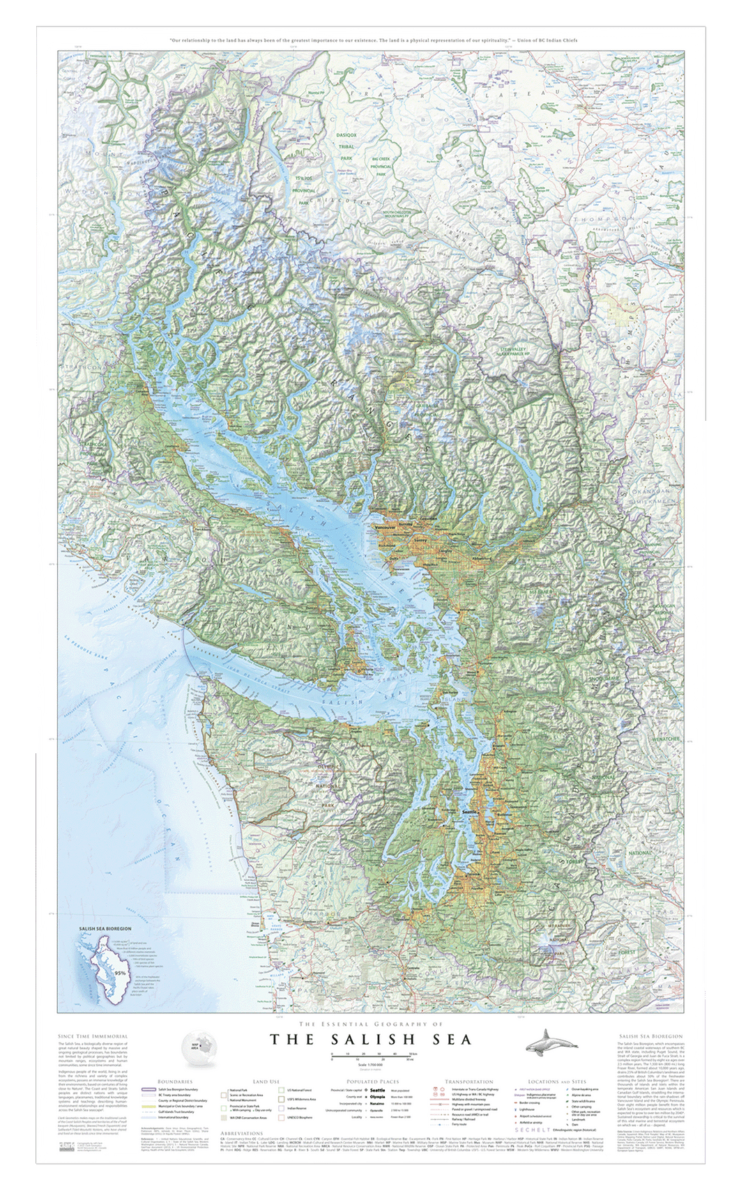
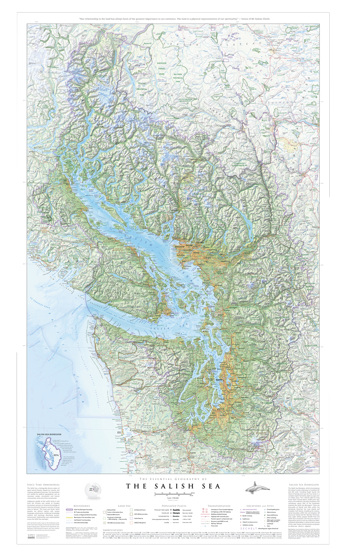
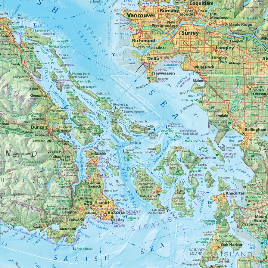
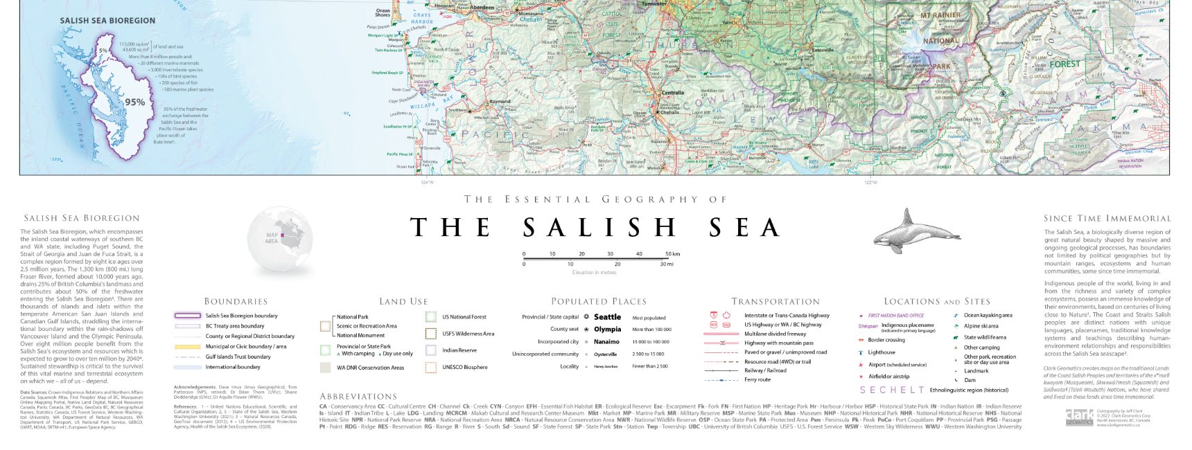
A Visual Introduction to the Geography of the Salish Sea
The Salish Sea is a complex inland marine region shaped by narrow straits, deep basins, island archipelagos, and a rugged, glacially carved coastline. Extending from the Strait of Georgia through the Gulf and San Juan Islands to Puget Sound, it forms one of the most intricate coastal systems in the Pacific Northwest.
This poster edition presents the Salish Sea as a connected physical landscape, offering a clear and visually engaging overview of the region’s land–sea relationships and coastal form.
What This Map Shows
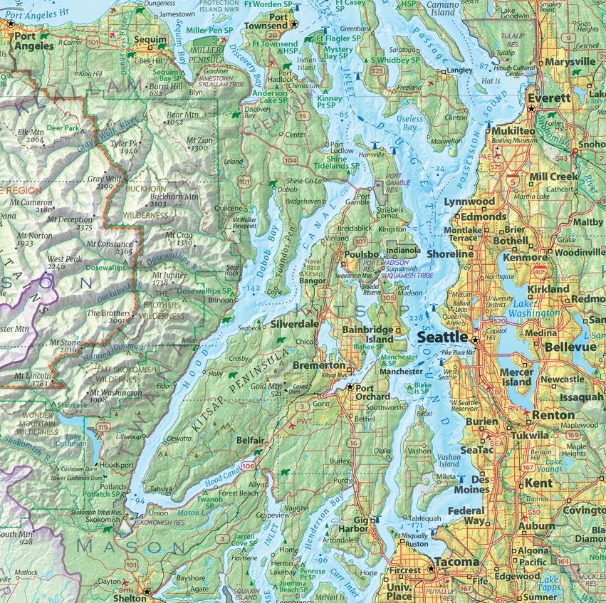
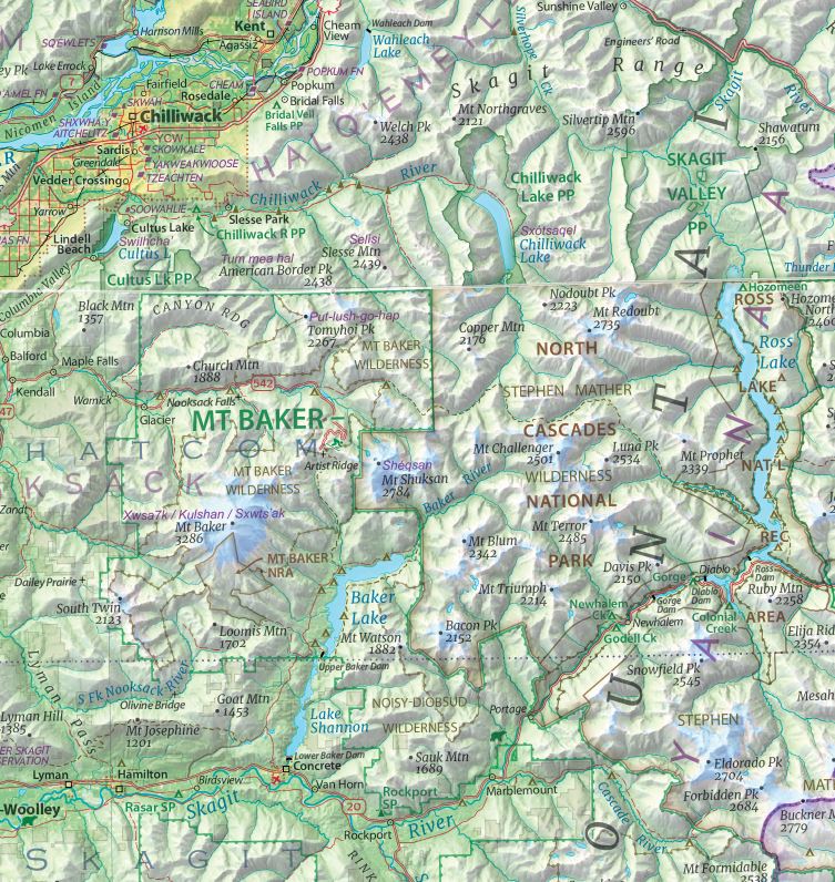
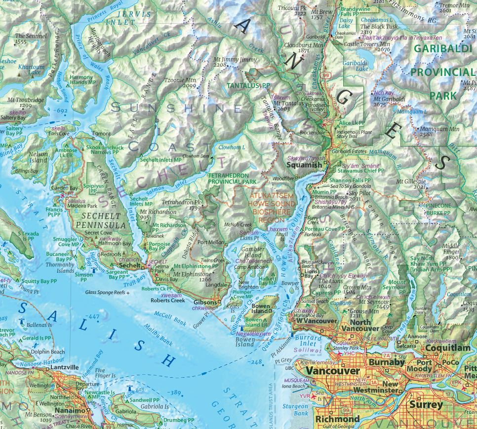
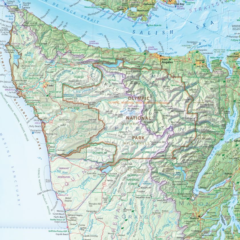
The map highlights the major geographic features of the Salish Sea, including island groups, channels, straits, and surrounding coastal mountain ranges. Shorelines are rendered with careful detail, allowing the structure of the coast and the spatial relationship between land and water to read clearly.
Bathymetry is included to convey the submerged landscape that defines the region, helping viewers understand the depth and continuity of the sea. Subtle shaded relief and restrained labeling maintain clarity in areas of high geographic density.
Cartographic Design and Approach
The map uses a clear, information-first cartographic approach focused on geographic structure rather than political boundaries. Coastlines, islands, channels, and underwater landforms form the visual foundation, allowing the physical character of the Salish Sea to take precedence.
Design choices are intentionally restrained to ensure the map communicates effectively at a distance while remaining readable and balanced.
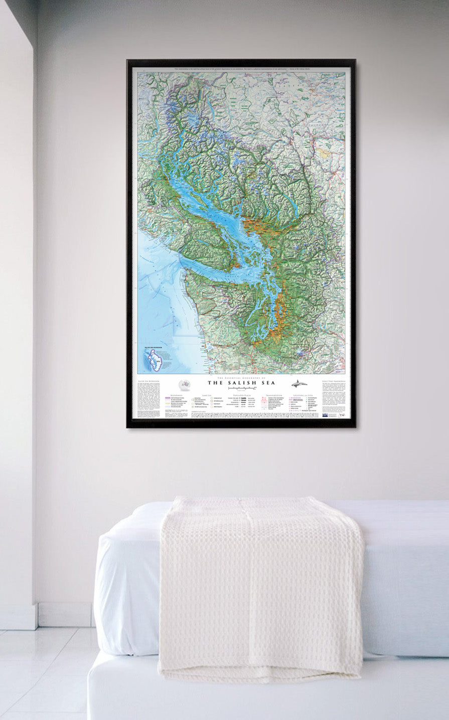
Print Quality and Physical Details
This poster is printed using offset UV press on high-quality poster paper, producing crisp linework and consistent colour at a lighter weight. The format is well suited to framing or pin-mounting and offers a durable, cost-effective alternative to photographic paper prints.
This version is optimized for display rather than close, fine-detail study, making it an accessible option for a wide range of spaces.
Who This Map Is For
This poster is well suited to anyone seeking a clear, visually engaging introduction to the geography of the Salish Sea. It works especially well in classrooms, offices, shared spaces, and as a gift, or for those who want an attractive overview of the region’s coastal geography.